Celebrating the Amazing Technology That Maps Our World
Imagine a world where emergency responders couldn't quickly locate an accident, weather forecasters struggled to track approaching hurricanes, and delivery drivers relied entirely on handwritten directions. Finding the nearest hospital might require a telephone directory, while planning a road trip could involve spreading an enormous paper map across the kitchen table and hoping nobody spilled coffee on it. Fortunately, modern mapping technology has transformed how we understand, navigate, and manage our surroundings. GIS Day, celebrated annually on the third Wednesday of November, recognizes the extraordinary contributions of Geographic Information Systems and the professionals who use them to make our world safer, more efficient, and easier to understand.
Geographic Information Systems, commonly called GIS, are powerful computer-based tools that collect, organize, analyze, and display information connected to specific locations. Although the name sounds like something requiring three university degrees and a very expensive calculator, the basic concept is surprisingly straightforward. GIS combines maps with information, allowing users to discover patterns, understand relationships, and make informed decisions about places and the people who live there. From tracking wildfires and planning new highways to protecting endangered wildlife and identifying suitable locations for businesses, GIS technology has become an essential part of modern life. And yes, it can even help you locate the nearest coffee shop, which some people would argue is among its most important achievements.
What Is GIS and How Does Geographic Information System Technology Work?
A Geographic Information System is much more than an electronic map. Traditional maps display roads, rivers, mountains, cities, and other physical features, while GIS adds layers of information that can be examined individually or combined to reveal important relationships. Imagine looking at a map of your hometown and being able to display population density, traffic patterns, property boundaries, flood zones, schools, hospitals, and emergency services. GIS allows users to examine these different types of information together, helping them answer questions that ordinary maps cannot easily address.
The technology works by connecting geographic locations with descriptive information stored in computer databases. A particular location might have details about its elevation, population, land use, average rainfall, or proximity to public facilities. By combining these records with digital maps, GIS software can identify patterns and relationships that might otherwise remain hidden. For example, city planners can compare population growth with existing road networks to determine where additional transportation infrastructure may be needed. Environmental scientists can examine changes in forest coverage over time, while emergency managers can identify neighborhoods most vulnerable to flooding.
One of the most useful features of GIS is its ability to present complicated information visually. Rather than studying thousands of individual records in a spreadsheet, researchers can display their findings on interactive maps that use colors, symbols, and geographic boundaries to explain what is happening. A map showing the spread of a wildfire, for example, can reveal threatened communities, evacuation routes, and nearby emergency resources. This ability to transform large amounts of information into understandable geographic pictures makes GIS valuable to governments, businesses, scientists, educators, and ordinary citizens.
The History of GIS Day and the Development of Modern Mapping
The history of GIS Day began in 1999, when the first formal celebration introduced the public to the growing importance of Geographic Information Systems. The event was supported by organizations involved in geography education and mapping technology, including Esri, a major developer of GIS software. Esri cofounder Jack Dangermond has credited consumer advocate Ralph Nader with inspiring the idea of a special day dedicated to demonstrating how geographic information technology benefits society. The celebration became associated with Geography Awareness Week, an educational initiative established by the National Geographic Society in 1987 to encourage greater understanding of geography and its importance in everyday life.
Although GIS Day began near the end of the twentieth century, the foundations of modern Geographic Information Systems developed decades earlier. One of the most influential pioneers was Canadian geographer Roger Tomlinson, widely recognized as the father of GIS. During the 1960s, Tomlinson helped develop the Canada Geographic Information System, an early computerized mapping system designed to analyze the country's land resources. His work demonstrated that computers could do considerably more than reproduce traditional maps. They could organize geographic information, compare different characteristics of the landscape, and support decisions about land management and resource planning.
As computers became more powerful and affordable during the 1970s, 1980s, and 1990s, GIS technology expanded into government agencies, universities, research institutions, and private businesses. Satellite imagery, digital databases, and improved mapping software made geographic analysis faster and more practical. The arrival of the internet and modern mobile devices subsequently brought location-based services into everyday life. Today, people routinely use digital maps to find destinations, monitor traffic, explore unfamiliar neighborhoods, and locate nearby services. The remarkable achievement is that technology once reserved for specialized researchers has become something millions of people carry around in their pockets, usually alongside photographs of their grandchildren and an alarming number of forgotten passwords.
GIS Technology in Everyday Life
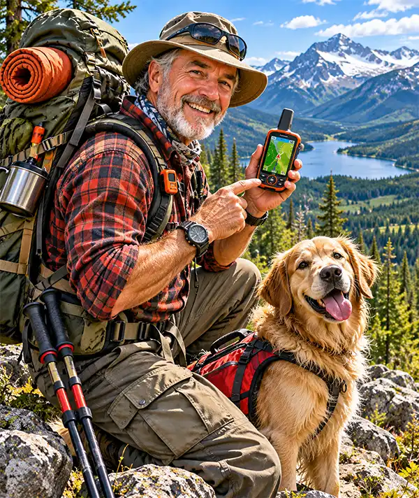
Many people use services supported by GIS technology without realizing it. Digital navigation systems, online mapping platforms, and location-based applications depend on geographic data and spatial analysis to help users find their way around. When a navigation application displays roads, nearby businesses, traffic conditions, and alternative routes, it draws on mapping databases and location-based technology. Although GPS and GIS are different systems, they frequently work together. GPS helps determine where a device is located, while GIS can organize and analyze information about that location and its surroundings.
Consider a family planning a vacation. Before leaving home, they can examine digital maps, identify suitable hotels, locate attractions, and compare possible routes. During the journey, navigation software can provide directions and help drivers avoid heavily congested roads. Travelers can also explore nearby restaurants, fuel stations, hospitals, and recreational areas. What once required several paper maps, a guidebook, and occasionally a heated discussion between the driver and navigator can now be accomplished using a smartphone. Of course, technology has not entirely eliminated family arguments about directions; it has simply introduced a computerized voice that occasionally joins the disagreement.
Businesses also depend on GIS to understand customers, organize deliveries, and select suitable locations for new facilities. Retail companies can study population patterns, transportation networks, and nearby competitors before opening stores. Delivery services use geographic information to plan efficient routes, while utility companies maintain digital records of pipelines, electrical networks, and other infrastructure. Farmers can combine location information with soil conditions, crop performance, and weather data to make more informed agricultural decisions. These applications demonstrate that GIS is not simply about knowing where something is located, but understanding why that location matters.
How GIS Helps Emergency Services and Disaster Management
One of the most important applications of Geographic Information Systems involves emergency preparedness and disaster response. Natural disasters can affect enormous geographic areas, making accurate information essential for protecting communities and coordinating emergency resources. GIS allows emergency managers to examine flood risks, hurricane evacuation zones, wildfire conditions, transportation networks, and the locations of vulnerable populations. By displaying this information on interactive maps, authorities can identify potential problems and prepare appropriate responses before disasters occur.
Hurricanes provide an excellent example of how geographic information can support public safety. Meteorologists use satellite observations, weather models, and geographic data to monitor storm development and predict possible impacts. Emergency management agencies can combine storm forecasts with elevation maps, flood zones, road networks, and population information to help plan evacuations and position emergency resources. In coastal regions, where storm surge and flooding can threaten entire communities, this information can be especially valuable. GIS does not prevent hurricanes, unfortunately, but it helps people prepare for them with considerably more precision than standing in the backyard and announcing that the clouds look suspicious.
Firefighters and emergency responders also benefit from location-based technology. During wildfires, GIS maps can display fire boundaries, terrain, roads, water sources, and nearby communities. Emergency medical services can use geographic information to understand service coverage and improve response planning, while public safety agencies can identify areas requiring additional resources. Following major disasters, mapping technology helps assess damage, locate affected infrastructure, and coordinate recovery efforts. These applications demonstrate how GIS contributes directly to protecting lives and property.
GIS and Environmental Conservation
Environmental scientists and conservation organizations use Geographic Information Systems to study natural habitats, monitor environmental changes, and protect vulnerable ecosystems. By combining satellite imagery, field observations, and geographic databases, researchers can examine deforestation, coastal erosion, changes in vegetation, and the movement of wildlife populations. GIS allows scientists to compare conditions across different periods, revealing how landscapes change and helping conservation planners identify areas requiring protection.
Wildlife conservation provides a particularly interesting example. Researchers can use GPS tracking devices and GIS analysis to study the movements of animals such as elephants, wolves, sea turtles, and migratory birds. These observations help scientists understand migration routes, feeding areas, breeding habitats, and potential threats from roads or development. Conservation organizations can then use the information to recommend wildlife corridors, protect important habitats, and reduce conflicts between human activities and animal populations. The animals themselves are generally unaware that their travels are being recorded, although one suspects a wandering elephant might be rather impressed to discover that its daily stroll has become the subject of an elaborate computer map.
GIS also supports environmental management by helping communities monitor water resources, identify pollution sources, and study the effects of climate change. Coastal researchers can examine changes in shorelines and sea levels, while forestry agencies can assess tree coverage and areas affected by disease or wildfire. Agricultural specialists can analyze soil conditions and water availability to support more efficient land management. These examples illustrate how geographic information helps people understand environmental challenges and develop practical approaches to protecting natural resources.
GIS in Urban Planning and Community Development
Cities and towns are constantly changing as populations grow, businesses expand, and transportation needs evolve. Geographic Information Systems provide urban planners with tools for understanding these changes and making decisions about future development. By examining population distribution, land use, transportation networks, public facilities, and environmental conditions, planners can identify suitable locations for new housing, schools, hospitals, and other community services.
Transportation planning is an especially important application of GIS. Engineers and local governments can analyze traffic patterns, road conditions, accident locations, and population growth to identify areas where improvements may be necessary. GIS can help determine where new roads might be needed, which intersections experience frequent congestion, and how public transportation services could better serve residents. These studies support decisions about infrastructure investments and community development. They cannot, however, guarantee that every driver will remember to use a turn signal.
GIS is also valuable for managing public utilities and essential services. Water departments can maintain maps of underground pipelines, electrical companies can track distribution networks, and local governments can organize information about public parks, drainage systems, and property boundaries. When repairs are required, accurate geographic records can help workers locate infrastructure and understand nearby conditions. In growing communities, GIS supports more coordinated planning by allowing different departments to work with shared geographic information.
GIS in Healthcare and Public Health
Geographic Information Systems play an important role in public health research and healthcare planning. Medical researchers can use geographic data to examine patterns in disease occurrence, environmental exposure, healthcare access, and population characteristics. By comparing health information with geographic locations, analysts may identify communities experiencing particular challenges or areas where additional medical services are needed.
The importance of geographic analysis in public health has historical roots. In 1854, British physician John Snow investigated a cholera outbreak in London by mapping the locations of deaths and examining their relationship to public water supplies. His investigation helped identify a contaminated water pump on Broad Street as a major source of the outbreak. Although Snow worked long before computers and modern GIS software existed, his use of location-based evidence demonstrated a principle that remains central to geographic analysis: understanding where events occur can help explain why they happen.
Modern public health organizations use GIS to support disease surveillance, emergency preparedness, and healthcare resource planning. Geographic analysis can help identify communities located far from hospitals, examine patterns of environmental hazards, and support the distribution of medical resources. These tools are particularly valuable when combined with reliable health data and appropriate privacy protections. GIS cannot replace medical expertise, but it can provide important geographic insights that help healthcare professionals and policymakers make informed decisions.
GIS in Agriculture and Food Production
Modern agriculture increasingly uses geographic information to improve efficiency, manage resources, and support crop production. Farmers can combine satellite imagery, GPS-guided equipment, soil measurements, and weather information to understand differences across their fields. This approach, commonly associated with precision agriculture, helps identify areas requiring particular attention and supports more targeted use of water, fertilizer, and other resources.
Rather than treating every acre of farmland as identical, geographic analysis allows farmers to recognize variations in soil quality, moisture levels, drainage, and crop growth. Agricultural equipment equipped with positioning technology can help guide planting, spraying, and harvesting operations, while digital maps provide records that can be compared over successive growing seasons. These developments can improve decision-making and reduce unnecessary resource use when supported by accurate information and appropriate farming practices.
GIS also helps agricultural researchers study drought conditions, monitor land use, and examine the effects of weather on food production. Government agencies and agricultural organizations use geographic data to assess crop conditions and understand regional farming challenges. The technology represents a considerable advance from the days when farmers relied primarily on experience, handwritten records, and looking toward the horizon while wondering whether it might rain before Thursday.
The Difference Between GIS, GPS, and Satellite Mapping
Although Geographic Information Systems and Global Positioning Systems are closely connected, they serve different purposes. GPS is a satellite-based navigation system that allows compatible receivers to determine their location and time. GIS, by comparison, is a system for organizing, displaying, and analyzing information associated with geographic locations. GPS can supply location coordinates that become part of a GIS database, but GIS can also work with information collected from surveys, aerial photographs, historical records, and numerous other sources.
Satellite imagery provides another important source of geographic information. Satellites equipped with specialized sensors collect observations of Earth's surface, allowing researchers to examine forests, oceans, cities, agricultural land, and other features. These images can be incorporated into GIS software and compared with additional data to study environmental conditions or changes over time. A satellite image might reveal the extent of a forest, while GIS analysis can combine that image with land ownership, roads, wildlife habitats, and historical records to answer more complicated questions.
Understanding these distinctions helps explain why modern mapping technology is so powerful. GPS can tell you where you are, satellite imagery can show you what an area looks like, and GIS can help explain the relationships between different features and activities in that location. Together, these technologies have transformed navigation, research, emergency management, and countless other aspects of daily life.
GIS Education and Careers in Geographic Information Science
GIS Day provides an opportunity to introduce students to geography, mapping technology, and careers involving geographic information. Schools, colleges, universities, government agencies, and professional organizations organize educational activities designed to demonstrate how GIS works and why it matters. Students may explore interactive maps, examine satellite images, collect geographic data, or investigate environmental and community issues using mapping software.
Geographic information science combines elements of geography, computer technology, mathematics, environmental studies, and data analysis. Professionals working in the field may become GIS analysts, cartographers, urban planners, environmental researchers, surveyors, or specialists in emergency management and transportation. Their responsibilities vary considerably, but they share an interest in understanding geographic information and using it to solve practical problems.
For younger students, GIS education can begin with simple activities such as mapping a school campus, identifying neighborhood landmarks, or comparing different types of land use. More advanced projects might examine local flooding, changes in vegetation, or access to public facilities. These exercises encourage critical thinking and help students understand that geography involves much more than memorizing capital cities. Although knowing where Nebraska is located remains useful, understanding how geographic information affects communities opens the door to an entirely different level of discovery.
How to Celebrate GIS Day
Celebrating GIS Day offers opportunities for people of all ages to explore the fascinating world of geographic information. Many universities, libraries, schools, government agencies, and professional organizations host demonstrations, workshops, and educational presentations during November. These activities introduce participants to interactive mapping, geographic analysis, and the practical applications of GIS technology. Some events allow visitors to experiment with digital maps or learn how geographic information supports environmental protection, public safety, and community planning.
Families can celebrate GIS Day by exploring online maps together and investigating familiar places from a different perspective. Comparing historical maps with modern satellite images can reveal how neighborhoods, roads, and landscapes have changed over time. Children might enjoy creating maps of their homes, schools, or local parks, identifying important features and learning how maps represent real-world locations. A family road trip can also become an educational activity by examining the geography of the route, identifying rivers and mountains, and discussing why towns and highways developed where they did.
For adults interested in technology, GIS Day provides an opportunity to explore free mapping resources, attend an online presentation, or learn the basics of geographic analysis. OpenStreetMap, for example, is a collaborative mapping project that allows volunteers to contribute geographic information. Publicly available mapping tools from government agencies and educational institutions can also help users investigate local environmental conditions, historical changes, and community characteristics. Even a simple exploration of neighborhood maps can reveal surprising details about familiar surroundings.
The Future of GIS Technology and Digital Mapping
The future of Geographic Information Systems is closely connected to advances in artificial intelligence, satellite technology, cloud computing, and the growing availability of geographic data. Modern GIS platforms can process enormous quantities of information, allowing researchers and organizations to examine geographic patterns across cities, countries, and entire continents. Artificial intelligence and automated image analysis are increasingly being used to help identify roads, buildings, vegetation, and other features in aerial and satellite imagery, although human review remains important for checking accuracy.
Three-dimensional mapping is another developing area of GIS technology. By combining geographic information with detailed models of buildings, roads, and terrain, planners can create digital representations of real-world environments. Some organizations use these models, often called digital twins, to examine infrastructure, evaluate development proposals, and explore possible effects of changing conditions. Such tools may help communities understand complicated planning challenges before expensive construction projects begin.
As geographic technology becomes more sophisticated, questions about data accuracy, privacy, and responsible use become increasingly important. Location information can reveal sensitive details about individuals and communities, making appropriate safeguards essential. Reliable GIS analysis also depends on current, accurate data and careful interpretation. A beautifully designed map can still produce misleading conclusions if the information behind it is incomplete or incorrect.
Despite these challenges, Geographic Information Systems will continue to play an important role in understanding a changing world. From managing growing cities and protecting wildlife to improving disaster preparedness and supporting scientific research, GIS provides tools for examining problems that have a geographic dimension. And since practically everything on Earth happens somewhere, that gives geographic information specialists a rather impressive amount of work to do.
GIS Day: Celebrating the People Who Help Us Understand Our World
GIS Day recognizes the technology, researchers, educators, and professionals who transform geographic information into knowledge that benefits society. Since its first formal celebration in 1999, the observance has grown into an international opportunity to demonstrate the importance of mapping, geographic education, and location-based analysis. What began as an effort to increase public awareness has become a celebration of technology used in environmental conservation, emergency management, public health, transportation, agriculture, and everyday navigation.
The significance of Geographic Information Systems extends far beyond producing attractive maps. GIS helps people identify problems, understand relationships, evaluate possible solutions, and make better-informed decisions. It connects geography with modern technology and demonstrates how understanding the location of people, places, and events can reveal valuable information about the world around us.
So, on GIS Day, take a moment to appreciate the remarkable technology that helps us find our destinations, prepare for disasters, protect natural resources, and understand our communities. Perhaps explore an unfamiliar place on a digital map, investigate the history of your hometown, or simply thank the people who keep geographic information accurate and accessible.
And the next time your navigation system announces that you've missed your turn, remember that GIS technology is doing its best. It may know exactly where you are, but convincing you to stop and ask for directions remains an entirely different scientific challenge!
GIS Day – Official Website — History, purpose, and annual celebration dates. References & Sources
Esri – History of GIS — Development of Geographic Information Systems and early pioneers.
National Geographic – Geographic Information Systems — How GIS works and its applications in science, government, and everyday life.
NOAA – What Is a Geographic Information System? — Geographic analysis, mapping, and environmental applications.
Library of Congress – GIS Day — Educational programs and the history of GIS Day celebrations.
GIS Day – Educational Resources — Classroom activities, mapping projects, and ways to celebrate.